| Differential corrections are applied in the form of measurement corrections (more rigorous and recommended approach) or position corrections. With either approach, the coordinates of one point which is used as a monitor/base station, must be known.
These different approaches are explained below: |
| |
| (a) Measurement domain differential or range correction method
|
- More flexible because the correction is made to the pseudoranges and hence the rover GPS receiver can use any combination of corrected ranges to obtain a solution, and not just the satellite constellation used at the base station.
- True range is found out after using known coordinates and calculated coordinates at known point (Figure 12.6).
- The errors computed at the monitor site thereby form differential corrections which are applied at the rover/remote site.
|
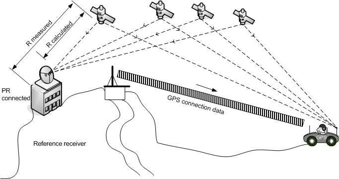
Figure 12.6 Range correction strategy (Rizos, 1999)
|
- Base station at known point in WGS84 or local datum
coordinates .
- Using known position, compute true range
- Generate corrections to all pseudo-range data by comparing
true to observed range.
- Transmit correction data to rover receiver for range
corrections before solution is carried out.
|
| (b) Position correction or block shift method
|
- Resulting positional errors at the monitor site form differential corrections which are applied at the rover site.
- Limitation : Both the rover and base receivers must use the same satellite constellation to generate their point solutions, otherwise severe errors can result, possibly worse than those of the (uncorrected) point positioning. This is a significant limitation as it is rarely the case that the same constellation of satellites are simultaneously visible if the two receivers are a long distance apart, or when the rover receiver is operating in cities, where the effect of urban canyons causes significant obstruction of the satellite signals.
|
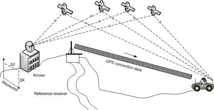
Figure 12.7 Position correction method (Rizos, 1999)
|
- Base receiver
at known point in WGS84 or local datum coordinates
.
- Compare known position and instantaneously computed
position.
- Generate correction dX, dY, dZ.
- Transmit correction to rover
receiver for immediate correction of raw point
coordinates.
|
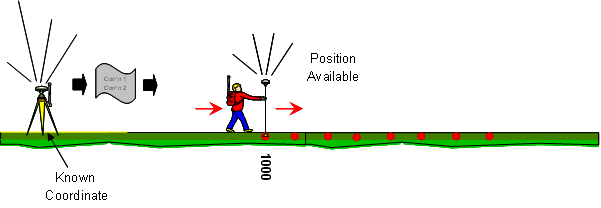
| In real Time DGPS: |
- As long as the rover is tracking a minimum of 4 satellites and receiving corrections from the reference station, a position is available
- It is recommended to wait for 15-30 seconds without moving the antenna before recording a point (this optimizes the code accuracy)
|
|
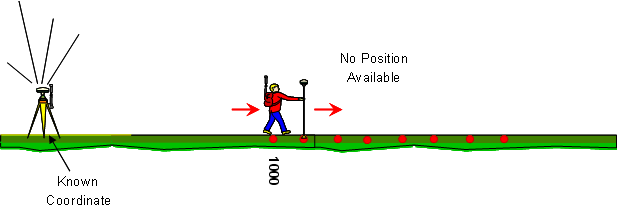
- If the rover is not tracking satellites or receiving corrections from the reference station, no position is available
|
|
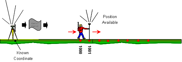
- As soon as the rover starts tracking satellites and receiving corrections from the reference station, the position becomes available again
|
|
| |