| Integration of Geoinformatics technologies
|
- GIS is designed to accept large volumes of spatial data, derived from a variety of sources including remote sensors with a capability to efficiently store, retrieve, analyse and display these spatial data. A GIS is both a database system with specific capabilities for spatially referenced data, as well as a set of operations for working with the data. GIS operates on many levels. On the most basic level, GIS is used as computer cartography, i.e. mapping. The real power in GIS is through using spatial and statistical methods to analyze attribute and geographic information. The end result of the analysis can be derivative information, interpolated information or prioritized information. GIS has been an effective tool for implementation and monitoring of projects.
- GIS is a convergence of technological fields and traditional disciplines. It is an integrated field and is often considered to be the science of spatial information. Various contributing disciplines include remote sensing, computer science, statistics, mathematics, civil engineering, geodesy, geography, surveying, photogrammetry, operation research and cartography.
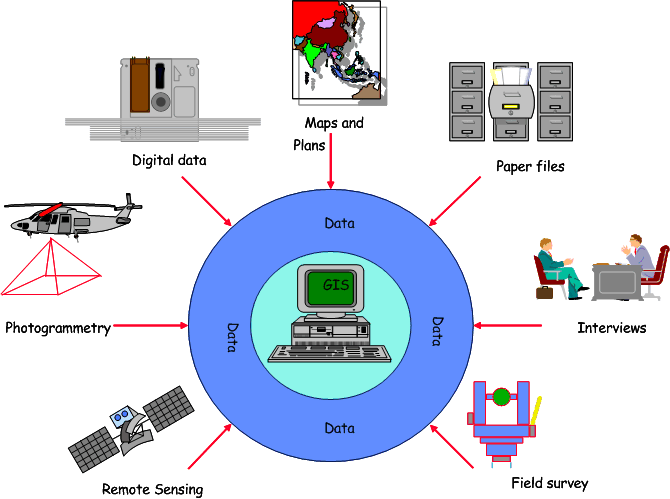
- The output from aforementioned disciplines may be given as input to GIS for further analysis and for deriving meaningful conclusions. With capability to store and manipulate large volume of data and excellent display capabilities, GIS can be easily used to process data from various sources (Figures 40.3). It is considered as the master integrator for the spatial data from different sources and helps to arrive at meaningful and better decisions.
- As a result of its ability to link data sets together, it facilitates interdepartmental information sharing and communication and helps in creating a shared database so that one department can benefit from the work of another thereby enabling multiple use of data. This also helps in reducing the redundancy, enhancement of productivity, and overall improvement of organizational efficiency.
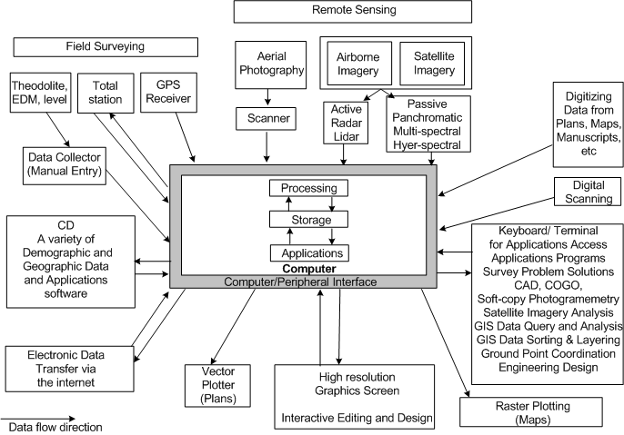
Figure 40.4 shows an integrated geoinformatics system where after collecting data from various sources, it can be efficiently stored, processed and analysed with computer in GIS framework.
|
|
Figure 40.3: GIS as master integrator for data from different sources
|
| Figure 40.4: An overview of integrated Geoinformatics technologies (Kavanagh, 2003)
|
| |
|