- Errors arising from our understanding and modelling of reality
- Different models have certain inherent assumptions
- Use of raster and vector model to portray reality
- Error due to source data
- Geometrical (positional) and semantic (classification) errors in the compilation of the source maps
- Interpretation and classification errors in remotely sensed data causing attribute error.
- Inaccuracy in source data i.e. from field sampling.
- Inaccuracies due to the range (fuzzy) character of natural boundaries, e.g. vegetation or soil type.
- Errors due to source data being out of date. This happens frequently in case of maps. Other errors with maps may be due to scale and generalization.
- Limitation of survey equipment
- Improper georeferencing of remotely sensed and photogrammetric data.
- Errors occuring during data input
- Digitizing errors due to operator mistakes and limited precision of digitizer. Errors during digitizing may be due to limitations of maps as given earlier or due to operational error. These operational errors may include psychological, physiological and digitizing method error.
- Errors in attribute data entry (typing errors).
- Errors in data storage
- Errors due to the limited precision with which coordinates and other numerical data are stored.
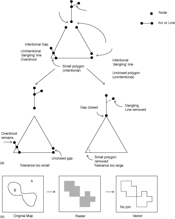
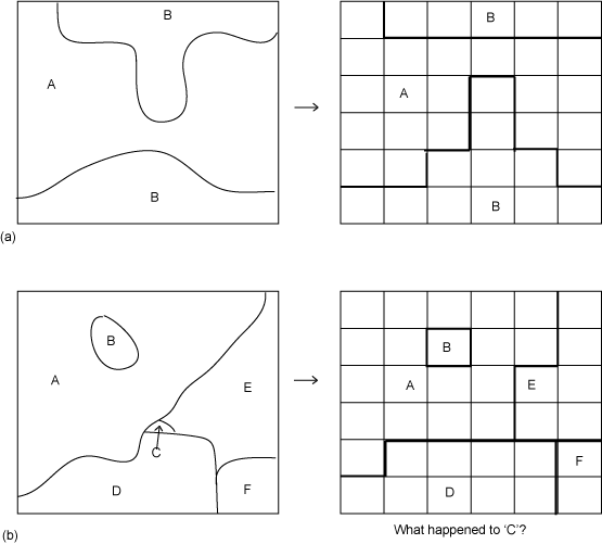
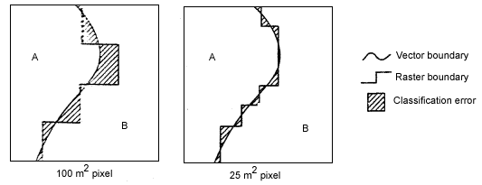
- Errors arising from rasterization / vectorization. Figure 2 describes various types of errors on these accounts.
- Errors in data analysis and manipulation
- Propagation of errors due to map overlay.
- Errors due to incorrect use of formula.
- Errors arising from interpolation e.g. for the determination of terrain slope from digitised contours.
- Errors in output and application
- Cartographic errors due to the limitation of the output device.
- Incorrect application of GIS products.
Figure 40.2 (I, II and III) shows different types of errors in pictorially in any GIS operation. |