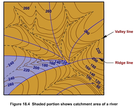
The catchment area of a river is determined by using contour map. The watershed line which indicates the drainage basin of a river passes through the ridges and saddles of the terrain around the river. Thus, it is always perpendicular to the contour lines. The catchment area contained between the watershed line and the river outlet is then measured with a planimeter (Figure 18.4).