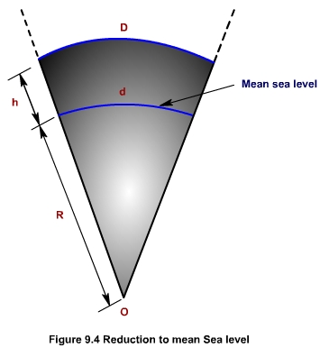
(Figure 9.4) In plane surveying, horizontal distances are reduced to sea level when it is required to count them into equivalent distance at another elevation, such as the plane coordinate system or the average elevation of a survey for which the variation in elevation over the area is large.
where, D is the measured distance on the surface of the earth;
R is the mean radius of the earth;
h is the mean height of the terrain above the msl.